Over 270 NZ Self Drive, Coach & Bus Tours
Browse our unrivaled selection of New Zealand tour vacations. Whether it's planning a self-driven adventure of the North and South Islands of New Zealand; travelling independently using New Zealand's nationwide bus and coach services, or experiencing a luxuriously laid back and fully guided coach tour of your chosen area, our expert team at Discover New Zealand is here to help you plan your perfect New Zealand tour experience!


We have self-drive road trips, guided coach tours, small group exclusive tours and daily departure independent coach tours across the North and South Island. Our team of NZ based travel experts can quickly create the perfect New Zealand holiday for you. Get in touch with them today to start planning your trip.
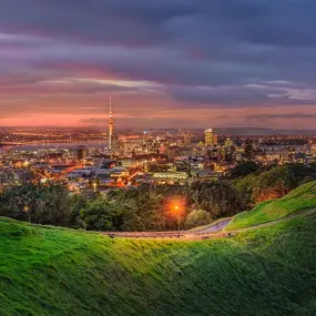
North Island Tours
From Cape Reinga to Cape Palliser, New Zealand's North Island has an incredible diversity of scenery and experiences. The wonderful marine reserves of Bay of Islands, Auckland's vibrant city centre, the thermal landscapes of Rotorua and the foodie scene in Wellington all ensure a great New Zealand holiday.
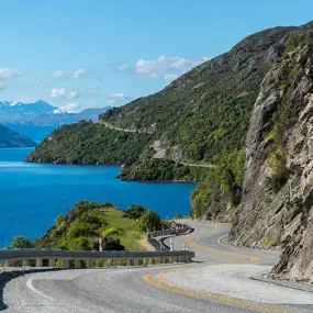
South Island Tours
Home to many of New Zealand's iconic locations and attractions, the South Island offers something for everyone. The incredible beaches of Abel Tasman, whale watching in Kaikoura, Mt. Cook and the Southern Alps, Queenstown's adventure and of course Milford Sound and the West Coast Glaciers.
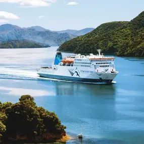
Countrywide Tours
See a range of tours that give you a taste of everything New Zealand is famous for. Tropical Northland, Coromandel beaches, Taupo and NZ's largest lake, Art Deco Napier, kayak with seals in Kaikoura, the French settlement of Akaroa, the Edinburgh of the South, Dunedin, Stewart Island and its friendly wildlife.
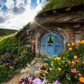
LOTR & Hobbit Tours
The movies of The Lord of the Rings and the Hobbit Trilogy showcased New Zealand in a way never seen before. These tour ideas guide you though the scenery and locations that were used throughout the movies. Specific LOTR or Hobbit themed activities and inclusions fully immerse you into Middle Earth.

Explore the wonders of New Zealand through our customisable tours, available for daily departures. If you prefer a well planned bus tour that lets you fully immerse in the experience without having to drive, then this is perfect for you. Take advantage of our top notch rail journeys that span throughout the country and make your trip even more enjoyable!

Our team of travel experts at Inside Australia Travel are dedicated to helping you plan and customise your dream Australian tour. We consider your personal preferences, budget, and timeline to create a one-of-a-kind itinerary. We can easily combine any Australian itinerary you see with a Discover New Zealand tour. Let us create the perfect holiday for you!
We have plenty of answers to your frequently asked questions. Read our FAQs and blogs for an insight into what you might need when you come to New Zealand, when is the best to travel and for lots of inspiration. Read all our blogs here.


We have all the answers you need to plan your perfect trip and holiday around New Zealand. Check out all our frequent questions here or get in touch with the team.
See what our guests have to say! We're proud to have shown thousands of people from all over the world around New Zealand. Read what they have to say about their Discover New Zealand Experience.


You can do that! Just get your preferred travel agent to contact our agent only division at www.nzsidekick.com and leave the rest to us. We promise it wont cost you anything more - guaranteed.


© Copyright 2025 Discover New Zealand | info@discovernewzealand.com